Drones have revolutionized the way we capture images and explore the world from above. Whether you’re a hobbyist or a professional drone pilot, having the right apps can enhance your flying experience and take your aerial photography and videography to new heights. In this comprehensive guide, we’ll explore the top drone apps available for both iOS and Android devices, covering everything from flight planning and navigation to photography and video editing. So, buckle up and get ready to soar high with the best drone apps!
Litchi for DJI Drones
Price: $24.99
Litchi for DJI Drones is an app that helps you fly your DJI drone safely and with pleasure, and it is one of the best drone apps. The app works in harmony with DJI Mini 2, Mini SE, Air 2S, Mavic Mini 1, Mavic Air 2, Mavic 2 Zoom/Pro, Mavic Air/Pro, Phantom 4 Normal/Advanced/Pro/ProV2, Phantom 3 Standard/4K/Advanced/Professional, Inspire 1 X3/Z3/Pro/RAW, Inspire 2, Spark.
Also, Litchi for DJI Drones comes with a horizontal, vertical, and 360-degree panorama mode and has a tracking mode that follows your every move. The app uses high-tech computer vision algorithms and allows you to keep your selection perfectly in a frame as you fly the drone. Users can switch from manual flying mode to automatic mode. For more information, visit Litchi’s website.
Litchi for DJI Drones on Google Play
Litchi for DJI Drones on the App Store
Also Read: The Best GoPro Apps
Google Maps
Price: Free
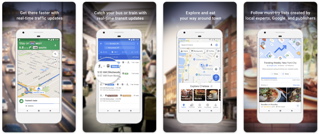
Google Maps is one of the most popular and user-friendly apps that drone users will love to use. The app contains weather information and offers a voice-command option. Users can search by filtering on Google Maps. The app can help users identify fantastic spots for photos and videos. Google Maps’s terrain mode allows you to understand the contours of the landscape and helps you choose the correct and suitable area.
Also Read: The Best Video Editing Apps for Android
Also Read: The Best Video Editing Apps for iPhone
B4UFLY Drone Airspace Safety
Price: Free
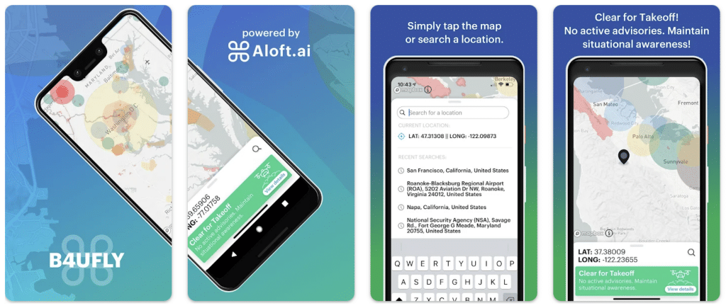
B4UFLY Drone Airspace Safety is a fantastic tool that allows users to do pre-flight field checks and is one of the best drone apps available. B4UFLY Drone Airspace Safety lets users examine local guidelines and regulations. The app assists users in flying securely and choosing where they wish to fly. Users can contribute to the app’s database by marking regions and adding new destinations in addition to B4UFLY’s recommendations. To learn more detailed information about the app, go to B4UFLY’s website.
B4UFLY Drone Airspace Safety on Google Play
B4UFLY Drone Airspace Safety on the App Store
PhotoPills
Price: $10.99
PhotoPills is considered one of the best drone apps for photographers who want to capture amazing scenery, the sky, and other photos with their drones. The app includes a 2D map-centered planner, a quick finder for sun and moon alignments, and 3D augmented reality. PhotoPills provides drone users with a location discovery tool to help them take fantastic pictures.
In addition, the app’s key information, such as Sunrise/Sunset, Twilight, Golden Hour, Blue Hour, Super Moon dates, the Lunar Calendar, and Moonrise/Sunset, is accessible to users. Long exposure, time-lapse, spot stars, star trails, hyperfocal charts, DoF, and FoV calculators are available on PhotoPills. Visit the website of PhotoPills to learn more.
Also Read: The Best Slow Motion Apps
DroneDeploy – Mapping for DJI
Price: Free
DroneDeploy is a functional app, especially for commercial drones. The app sends weather data to drone users and includes interactive maps and 3D models. Users can use the app to easily fly their drones autonomously and access high-resolution maps. The app is compatible with the following drones: Mavic 2 Pro / Zoom / Enterprise, Mavic Pro, Mavic Air, Phantom 4 Pro V2, Phantom 4 Pro / Advanced, Ghost 4, Inspiration 2, Matrix 100, Matrix 200 / 210 /210 RTK V1/V2, and Matrix 600.
Furthermore, DroneDeploy provides over 30 million acres of mapping and analysis, as well as flight plans in over 160 nations. The app allows users to perform in-field data analysis by measuring height, distance, volume, and area. DroneDeploy features First Person View (FPV) and one-touch manual flight. Go to DroneDeploy’s website for more information.
DroneDeploy – Mapping for DJI on Google Play
DroneDeploy – Mapping for DJI on the App Store
UAV Forecast for Drone Pilots
Price: Free/In-App Purchase: Up to $49.99
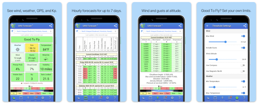
UAV Forecast for Drone Pilots is a simple app compatible with DJI Phantom, DJI Spark, DJI Mavic, DJI Mavic Pro, DJI Inspire, 3DR Solo, Parrot Bebop, Yuneec, and more, and stands out among the best drone apps. The app contains GPS satellites and solar activity (Kp).
The app also provides real-time airspace information, such as restricted zones, no-fly areas, and temporary flight restrictions, helping pilots stay compliant with regulations and avoid potential hazards. Additionally, UAV Forecast offers features like sunrise and sunset times, moon phases, and GPS signal strength, making it an indispensable tool for drone enthusiasts of all levels.
UAV Forecast for Drone Pilots on Google Play
UAV Forecast for Drone Pilots on the App Store
Also Read: The best apps to speed up video
Sun Surveyor (Sun & Moon)
Price: $7.99 for Google Play / $9.99 for the App Store
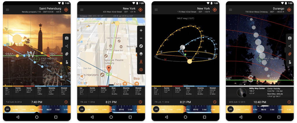
Sun Surveyor is an app with functional features that users who use their drones for artistic films and photos will love. The app features an interactive map (street view), a live camera view, a 3D compass, rich information about the moon and the Milky Way, and more. Users can use Sun Surveyor for blue hour, golden hour, sunrise/sunset, moonrise/set, and more. The app is also appropriate for night photography and provides offline use.
Sun Surveyor (Sun & Moon) on Google Play
Sun Surveyor (Sun & Moon) on the App Store




Comments
Loading…