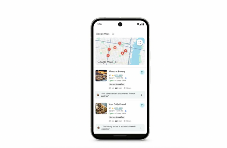
Google has rolled out a new developer feature for its Gemini AI models that connects artificial intelligence with real-time data from Google Maps, allowing apps to deliver location-aware responses based on live geographic information.
The update is now available globally through the Gemini API. It enables developers to pair Gemini’s reasoning capabilities with up-to-date geospatial data from more than 250 million mapped locations. Applications built with this integration can now reference business hours, user reviews, addresses, and nearby points of interest — all grounded in verified Maps data.
According to Google’s developer team, the new feature is designed to strengthen factual accuracy and contextual depth in AI-generated responses. Developers can include coordinates, such as latitude and longitude, within API calls to refine the AI’s answers based on user location. In practice, that could allow chatbots or travel assistants to provide localized restaurant suggestions, itinerary planning, or even real-time delivery route updates.
The Maps grounding capability is available across Gemini’s leading model tiers, including Gemini 2.5 Pro, Flash, Flash-Lite, and 2.0 Flash. A live demo hosted in Google AI Studio showcases how users can ask for recommendations, see detailed place information, and even interact with a built-in Google Maps widget that displays photos, ratings, and directions.
Developers can also combine Grounding with Google Maps and Grounding with Google Search in the same request. The pairing lets Gemini use Maps data for structured information like hours and addresses, while Search adds dynamic context such as news, events, or promotions. Google says internal testing found that combining the two tools significantly improves the quality and specificity of AI responses.
Potential apps range from hyper-local real estate search and tourism planning to logistics and retail personalization. For example, a real estate app could automatically identify listings near schools or playgrounds, while a travel planner could generate full-day itineraries complete with travel times and open hours.
Google is charging $25 per 1,000 grounded prompts for developers using the tool, with recommendations to enable grounding selectively for location-relevant use cases.
The Maps integration builds on Google’s broader effort to blend AI with real-world data sources. The company says developers must clearly attribute Google Maps as a source and cannot use the feature for emergency response applications.
Grounding with Google Maps is now available in the Gemini API and accessible through Google AI Studio, where developers can test, customize, and remix demo applications to fit their use cases.


Comments
Loading…